Overview
Flatirons Vista Trail is a scenic open-space trail located on the southern edge of Boulder, Colorado. As the name suggests, this trail offers expansive vista views of the iconic Flatirons, making it a popular destination for walking, hiking, and nature photography.
The area features multiple loop options, allowing visitors to choose routes based on time, fitness level, and desired scenery.
- Official site: Flatirons Vista (City of Boulder Open Space and Mountain Parks)
- Official map: OSMP Trail Map
- Maximum distance: approx. 3.5 miles (loop options available)
🔎 Boulder Trail Index (All Trails)
Location
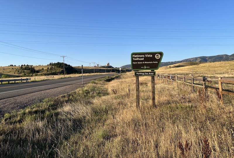
Flatirons Vista Trailhead (North)
Flatirons Vista North
Boulder, CO 80303
(📍 Google Maps)
Parking
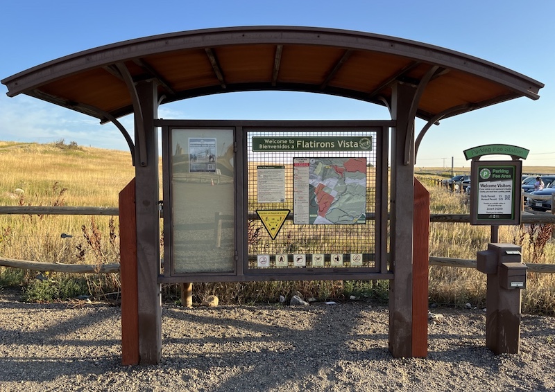
Parking is available near the trailhead, with a relatively large parking area. However, it may fill up during peak hours and on weekends.
- Vehicles registered in Boulder can park for free
- Non-Boulder vehicles require a parking fee
(see “OSMP Parking Permits and Fees” on the City of Boulder website)

In addition to the main lot, some visitors park along the shoulder of Highway 93 (Boulder–Golden Highway), though this is not an official parking area.
Trail Options and Access
This area offers several well-maintained loop trails:
- Short loop: approx. 0.4 miles
- Medium loop: approx. 1.7 miles
- Long scenic loop: approx. 3.2 miles
The 3.2-mile loop is especially recommended, as it provides the best views of the Flatirons and surrounding foothills.
Trail Conditions and Views
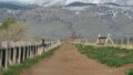
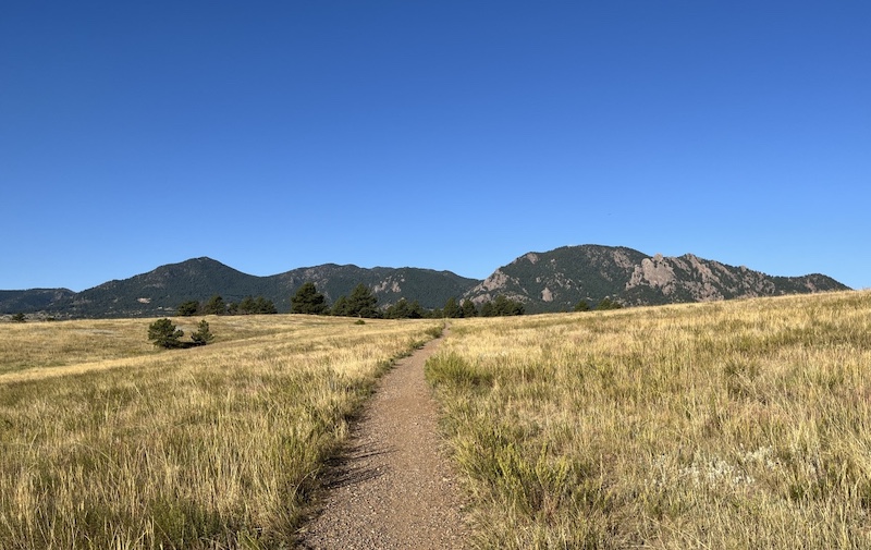
The trail begins with a gentle, gradual incline, making it accessible for most hikers. As the trail opens up, wide panoramic views of the Flatirons dominate the landscape.

The open terrain and unobstructed sightlines make this trail particularly appealing for sunrise and sunset walks, as well as landscape photography.
Flatirons Viewpoint
From multiple open sections along the trail, hikers can enjoy a direct, frontal view of the Flatirons. True to its name, Flatirons Vista Trail emphasizes expansive scenery rather than dense forest hiking.
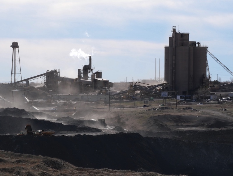
Nearby Industrial Features
To the southeast of the trailhead, you may notice the Arcosa Lightweight concrete facility (https://arcosalightweight.com/). While visible from certain sections of the trail, it does not detract significantly from the overall experience.
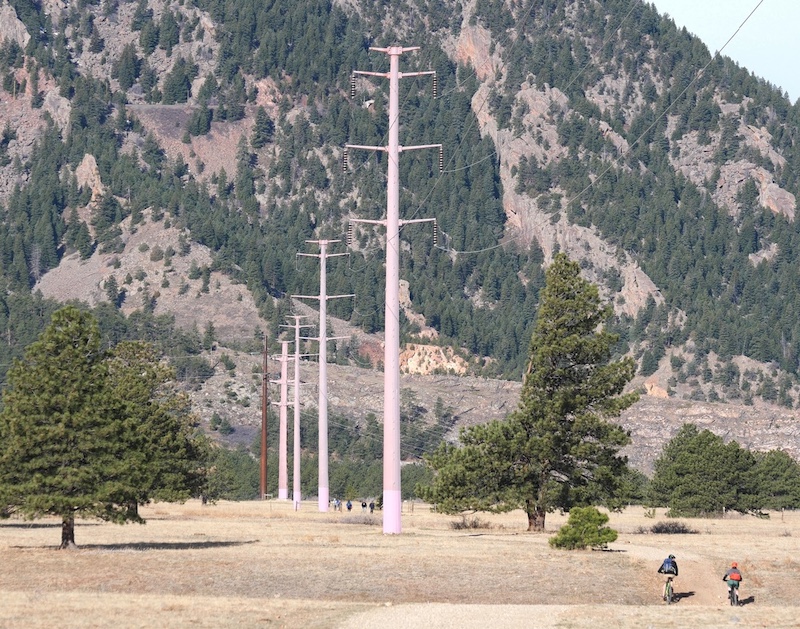
Power Lines
In some segments, overhead power lines cross above the trail. These are limited to specific areas and are easy to pass through.
Vegetation
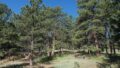
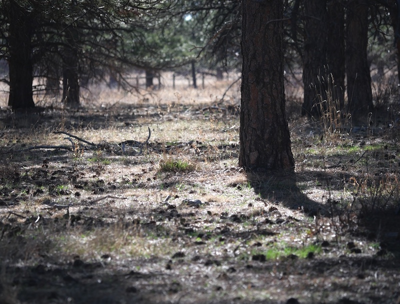
Pine Forest
As the trail enters wooded sections, hikers will encounter forests dominated by Ponderosa pine (Pinus ponderosa). These trees provide shade and add variety to the otherwise open landscape.
Pond
Approximately 0.2 miles from the trailhead, there is a small pond near the trail. Depending on the season, waterfowl may be observed here, making it a pleasant spot for a short rest or photo stop.

Related Book
The Best Urban Hikes: Boulder (English Edition)
Related chapter: Flatirons Vista Loop
This guidebook provides additional context and route details for urban and near-urban hikes around Boulder, including Flatirons Vista.

→ Explore more trails: Boulder Trail Index
This page is part of a growing local trail archive maintained by the YRAIN Project.