Overview
Official site:
Davidson Mesa Open Space (City of Louisville)
Location:
McCaslin Boulevard and Washington Avenue
Official map:
OSMP Trail Map (City of Boulder)
Trail distance:
A large loop of approximately 3.2 miles, starting from the trailhead and extending near Highway 36
(Difficulty: Easy)
🔎 Boulder Trail Index (All Trails)
Location
Davidson Mesa Trailhead
McCaslin Boulevard and Washington Avenue
Louisville, CO 80027
(📍 View location on Google Maps)
Parking
Parking for the trailhead is located on the west side of McCaslin Boulevard.
Across the road is Harper Lake, which connects directly to the trail system.
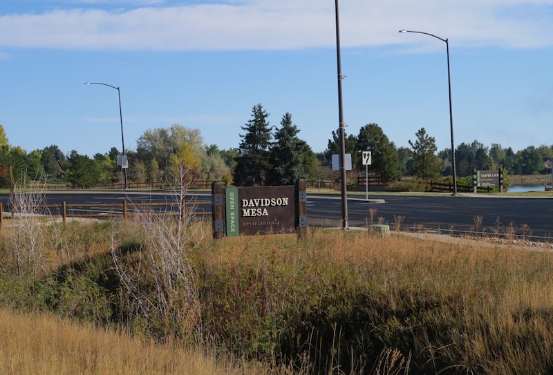
Free parking is available on both sides of McCaslin Blvd — at the designated trailhead lot and on the Harper Lake side.
Trailhead
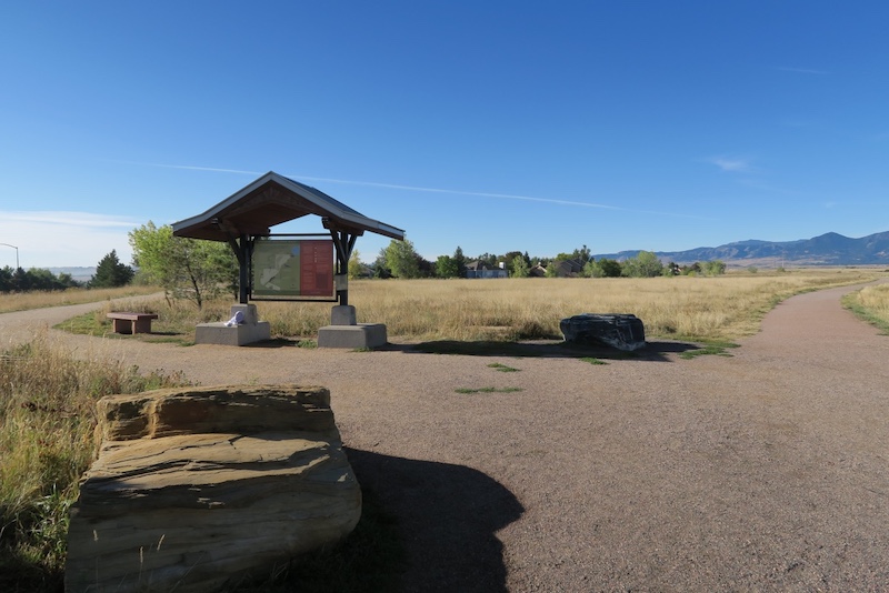
One of the highlights of Davidson Mesa Trail is that it offers multiple interconnected loops, allowing you to return without retracing the same path.
For example, you can follow the path on the right side of the photo, make a wide loop near Highway 36, and return via the path on the left side.
This route totals about 3.2 miles, taking approximately 1 hour on foot, or about 25 minutes when running.
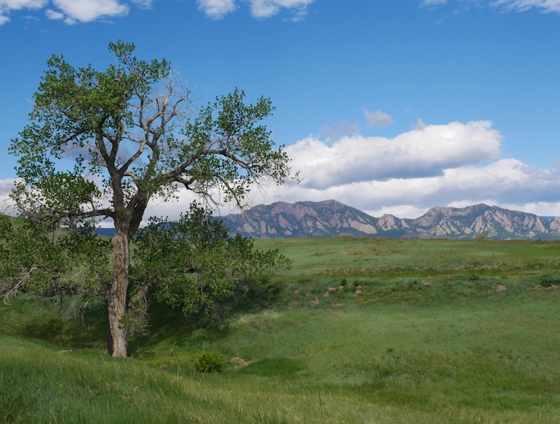
Trail Conditions and Scenery
The trail is mostly flat, making it ideal for walking, running, and cycling.
The landscape reflects typical Colorado vegetation, with very few artificial structures.
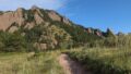
On clear days, you can enjoy excellent views of the Flatirons, one of Boulder’s most iconic mountain formations.
Because there is very little shade, it is recommended to wear sun protection during the day, such as long sleeves, sunglasses, and a hat.
The Flatirons
Foggy Mornings
When fog settles over the area, the scenery becomes especially atmospheric and quiet.
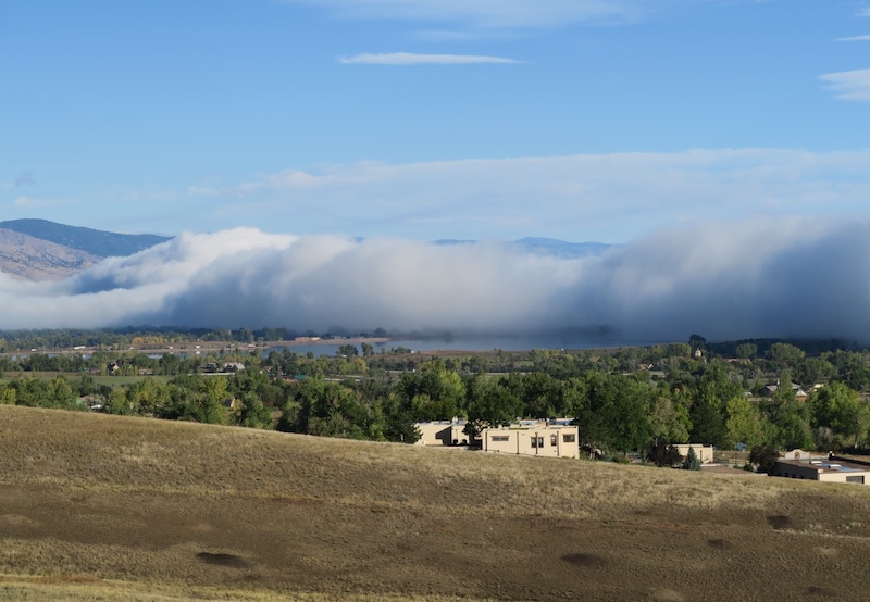
As the fog begins to lift, you can sometimes see patches of fog lingering over nearby areas of Boulder.
In the photo, South Boulder Reservoir is visible in the distance.
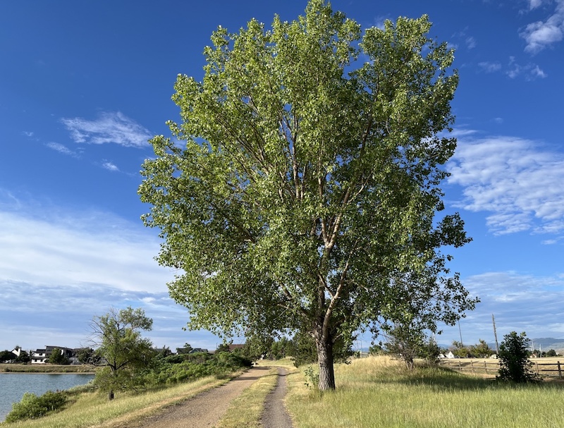
Harper Lake
Harper Lake, which connects directly to Davidson Mesa Trail, features a large cottonwood tree along its shoreline
(see also: “Cottonwood (Plains Cottonwood) – An American Tree”).
A photo for my daughter’s high school graduation album was taken beneath this tree.
Wildflowers
In early summer, especially in June, you can find open areas filled with bindweed flowers along the trail.
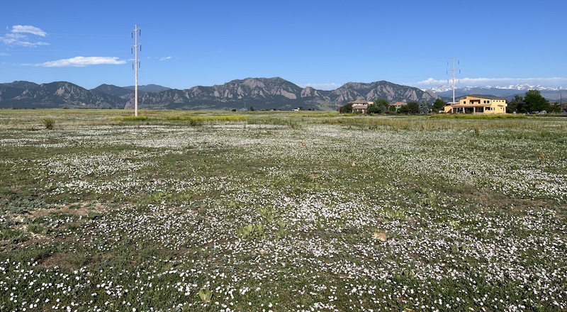
The mountains visible in the distance are the Flatirons.
White Rainbow (Fogbow)
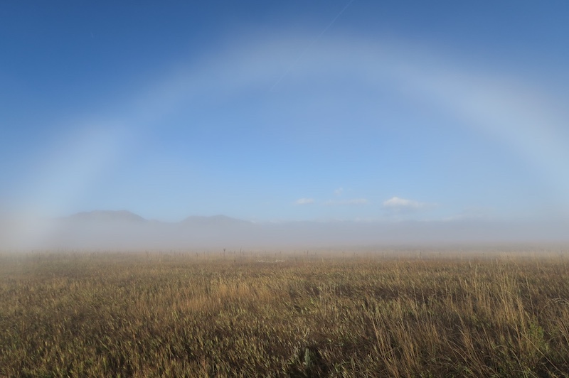
On foggy mornings, it is sometimes possible to see a white rainbow, known as a fogbow, formed by light interacting with tiny water droplets in the fog.
Highway 36 Connection
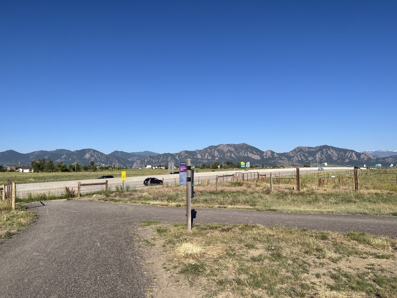
The trail also connects to a rest area along Highway 36, which links Boulder and Denver.
Along Highway 36, a concrete multi-use path runs parallel to the road, allowing cyclists to continue toward Boulder or Denver without interruption.
Related Book
The Best Urban Hikes: Boulder
Related chapter: 20. Harper Lake and Davidson Mesa Figure 8
(Amazon links: United States)

→ Explore more trails: Boulder Trail Index
This page is part of a growing local trail archive maintained by the YRAIN Project.