Overview
The Meadowlark Trail and Mayhoffer Singletree Trail begin at Oerman-Roche Trailhead in the town of Superior, Colorado, just southeast of Boulder. These trails offer open grassland scenery, gentle elevation gain, and wide views of the Front Range.
This area is part of Boulder County Open Space, and seasonal wildlife and grazing management may affect trail access.
🔎 Boulder Trail Index (All Trails)
Basic Information
- Official site: Coalton Trailhead / Boulder County
- Official map: OSMP Trail Map (City of Boulder)
- Location: 414 McCaslin Blvd, Superior, CO 80027
(📍 View on Google Maps)
Trail Directions
- Meadowlark Trail heads southwest, gradually climbing up a broad grassy hill.
- Mayhoffer Singletree Trail first descends slightly to the northwest before climbing toward higher ground.
⚠ Note: Portions of the trail system may close seasonally due to cattle grazing. Always check official sources before visiting.
Parking
The Oerman-Roche Trailhead parking lot is relatively large and often has available spaces.
If approaching via McCaslin Blvd, you must be traveling southbound to turn into the entrance. Drivers coming from the north will need to turn around.
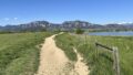
Views of the Flatirons
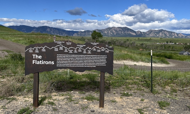
Because the trailhead sits slightly above the surrounding plains, you get good views right from the start. As you gain elevation, the iconic Flatirons come into view, with the higher peaks of the Front Range beyond.
Meadowlark Trail Experience
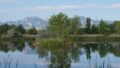
Starting from Oerman-Roche Trailhead, Meadowlark Trail leads you through open prairie landscapes toward the top of a rolling hill.
As you continue north, you may spot the parking lot of Coalton Trailhead in the distance, located on the opposite side of McCaslin Blvd.
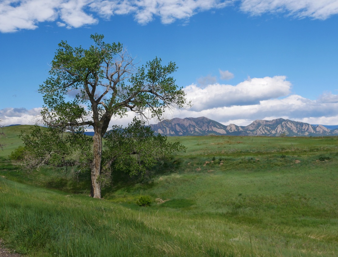
Hilltop Plateau
From the hilltop plateau, the scenery really opens up. In addition to the Flatirons, you can often see Mount Audubon in the Indian Peaks Wilderness on clear days.
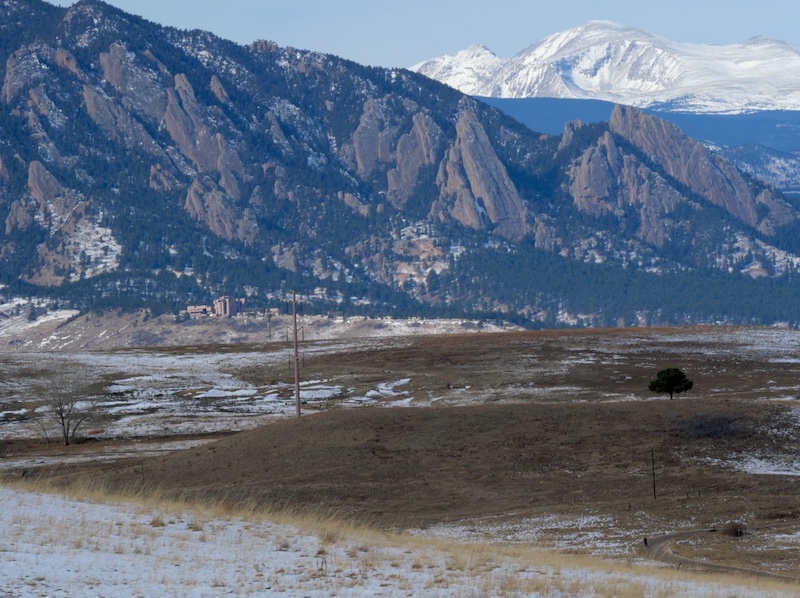
This is one of the best spots along the trail for panoramic views and photography.
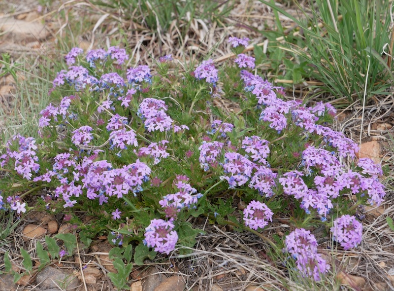
Wildflowers
From spring through fall, a variety of wildflowers bloom along the trail. The photo below shows a purple wildflower seen during a May hike.
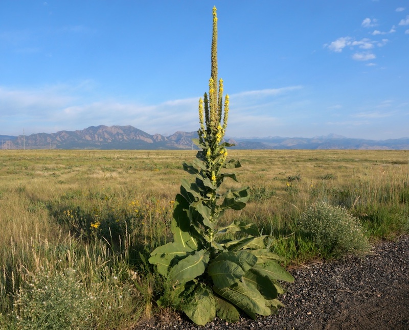
Common Mullein
Tall common mullein plants are frequently found on the upper parts of the trail. Their height and distinctive shape make them easy to spot from a distance.
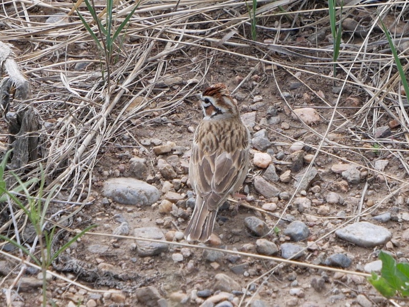
Birds
True to the name “Meadowlark,” this grassland habitat supports many small birds.
The bird shown below is a sparrow, possibly a Chipping Sparrow or Lark Sparrow.
Related Book
Best Boulder Region Hiking Trails
Related section: Hike 4 – Coal Creek Trail
(Amazon United States)

→ Explore more trails: Boulder Trail Index
This page is part of a growing local trail archive maintained by the YRAIN Project.